Tuesday, April 29, 2014

Zion National Park


After leaving Page AZ we spent an afternoon and the better part of the next day visiting Zion National Park.  It was threatening rain on the afternoon of our arrival.  We drove to the park looked at the visitors center and took a few pictures from highway pullouts.  Go my Flickr page to see more photos.

The change in geology as we entered the park was stark with hills of somewhat crumbling sandstone boulders and dirt suddently changing to solid rock mountains.
 The mountain above is called the checkerboard due to the crosshatched grooves eroded in the rock.
The road entering the East side of the park includes sever tunnels.  One of the tunnels is nearly  a mile long through the solid rock with  several "windows" excavated into the rock face.

Returning to the campground at dusk  it was drizzling rain and continued to rain though the night.  In the morning we found a coating of meting snow on everything.

We revisited the park later in the morning.  The drizzle continued of and on during the day.  We still managed to get quite a few good pictures with the clouds adding a somewhat dramatic element many of the images.

We rode the free shuttle bus up the narrow canyon and walked from the last stop until the the paved trail turned into the  primitive "Narrows" trail into the slot canyon.


 Ina at the end of the paved trail.

Finally, accordng to the Park Service, here is the most dangerous creature in the park.  People often try to feed the squirrels and get bitten.  They are so used to seeing people that one is  tempted to approach them like pets.
Please feel free to post your comments/suggestions in the box below.  Coming soon:  posts on Bryce and Capital Reef National Parks.

Glen and Antelope Canyon, Page Arizona

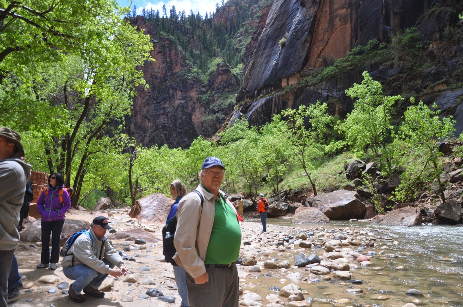
I'm getting behind on the blog posts.  We've done quite a bit of traveling since the Grand Canyon posts.  From Williams Arizona we traveled to Page Arizona where our objective was to visit Antelope Canyon.  At Page we also found the Glen Canyon Dam and the Horseshoe Bend of the Colorado River (just to the south of the dam).  I'll minimize the travel dialog so as to quickly get this post uploaded.  Since Page, we have also visited Zion and Bryce National Parks.  Those postings will have to wait for a later date.  We took a lot of photos.  The ones shown here are only a portion of those on our Flickr site.   Please feel free to leave your comments about the blog.

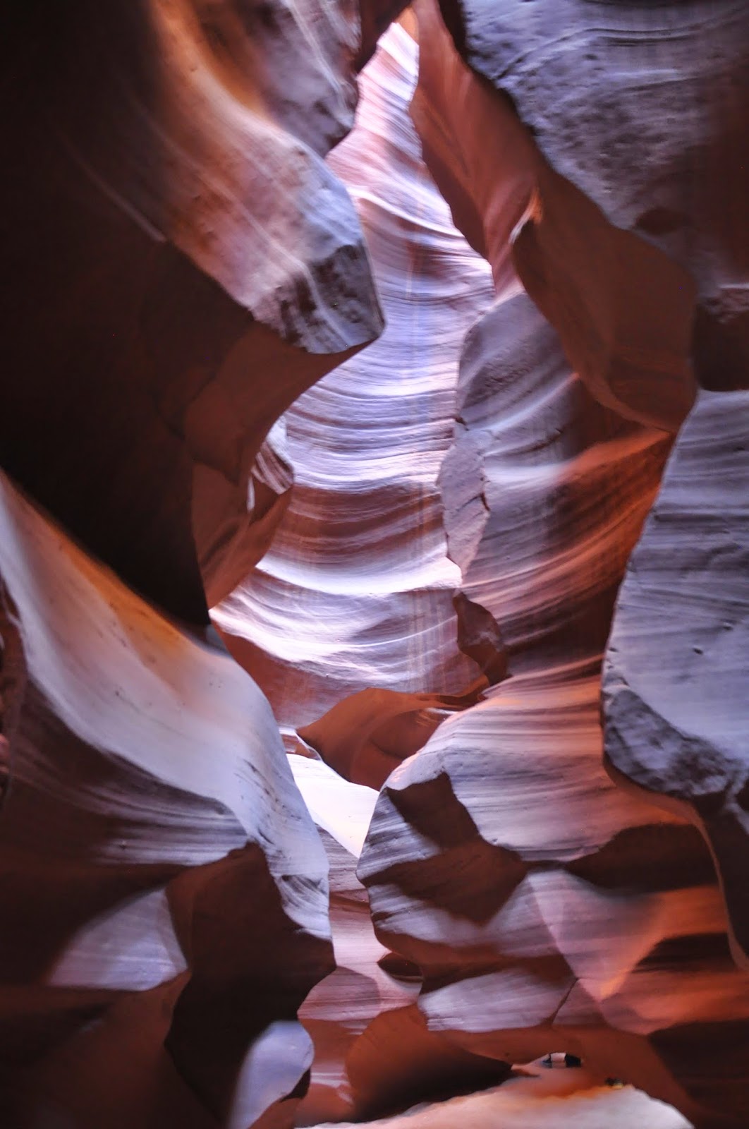
Antelope Canyon is not publicly accessible and can only be visited by Navajo guided tours.

 Ina didn't like the somewhat dusty ride in the truck.

The tour was well worth the cost.  The water sculpted walls are colorful and simply amazing.


After lunch we took the tour of the dam.
 Glen Canyon dam was built in 1959-60 and is larger than the 1920s built Hoover dam (some 200 miles downstream)
 They built the bridge first.
 Only three of the huge turbine generators were on line.  Several years of drought has resulted in fairly low lake levels (about 130ft below maximum).
 Lake Powell hosts a very large number of houseboats.  A great vacation would be rental of one of these to explore the some 180 miles of shore line.
 Just down stream from the dam the river makes a hairpin turn, aka Horseshoe Bend.  The bend is about a mile from the parking lot.  After hiking down to the bend, to see the entire bend you have to be brave enough to peer over the side of the thousand foot cliffs.


Finally, Ina took a liking to this painting in the dam visitor center.  The one here is a copy a downloaded from the Internet.  The painting was meant to depict the westward expansion concept of "Manifest Destiny"

Wednesday, April 23, 2014

The Grand Canyon

From Williams Arizona the Grand Canyon National Park is about 50 miles due North.  We spent two days visiting the park with an idle day between visits.  Luckily the weather was good for the better part of both days.  The park was fairly crowded with families due to the Easter break.

We were surprised at the number of rental motorhomes in the parking lot.  Many of these class-c RVs were rented by foreign tourists who for lack of a toad vehicle use the motorhome for touring.


On the first day Thursday (4/17)  we drove to the visitor center at Mather Point.  We took the free shuttle bus to the Bright Angel trail head.

From the trail head, the road which parallels the rim to the west is open only to the shuttle and tour buses.  The free buses are convenient as they run every 10 minutes. The Bright Angel trail runs from the south rim all the way to the bottom of the canyon (approx 6 miles one way and over 2000 ft elevation change).  Needless to say, such a challenging hike was not our cup of tea.


We took the shuttle bus about half way to the western terminus (Hermit's Rest) and then walked a couple of short legs of the rim trail back to catch the return bus to Bright Angel trail head.


After hamburgers in the restaurant at the Bright Angel lodge we boarded the bus again and rode allthe way to Hermit's Rest.  By this time of day (mid-afternoon) we hoped to get  better pictures due to the shadows cast by the sun's lower position in the sky.  The Hermit's Rest gift shop itself is interesting one of the oldest park  buildings.

We hiked about a mile eastward on the rim trail from Hermit's Rest.


Riding the shuttle we got back to the visitor center at about 4:30PM where we encountered some four legged visitors.


After a day's break back at the campground, we headed back to the park planning to drive the road to the east of the visitor center.  Follow the link to the next post.

Grand Canyon 2nd day and Wupatki National Monument


The weather with its scattered rain cloud cover produced better pictures than the first days visit. 


The photos below are at overlooks along the twenty mile rim road from the visitor's center toward the eastern end of the park. 


As we neared the eastern park entrance the clouds became more threatening.  
On the next to last  overlook the temperature dropped from the 70's into the 40's and rain began to fall becoming sleet after a few minutes.

We did not stop at the last two overlooks due to sleet which coated the ground like a dusting of snow.  Descending to lower elevations outside the park, the roads were totally dry and the temps were back up in the upper 60's.  The Colorado river drainage outside the park also produced several deep canyons on the Navajo reservation.

 On road south toward Flagstaff there are two national monuments;  the Wupatki indian ruins; and a 700 year old volcano cinder cone, Sunset Volcano.


 The ruins were abandoned in the several hundred years before the volcano erupted.  It is thought that 200-300 people lived here.  Below is what the city looked like when still occupied.

Humphrey's peak looking West from the volcano. The Sunset Volcano (below)
Finally back at the campground I saw this million dollar Marathon/Prevost coach arrive and setup next to the little rPod trailer.  Kind of a stark contrast in RV lifestyles.  All of these Grand Canyon photos can also be seen on our Flickr.com photostream.